Претрага
1969 items
-
Correlation of uniaxial compressive strength with the dynamic elastic modulus, p –wave velocity and s –wave velocity of different rock types
Knowing mechanical properties of rocks incorporated with ultrasonic waves velocities investigations provide a secure basis for mine modelling. Uniaxial compressive strength, dynamic elastic modulus and ultrasonic waves velocities are just some of the rock properties that indicate on presence of discontinuities, stratification and fissures of rocks. Determining the relationship of these rock properties testing the rock samples that are corresponding to different rock types extracted from different mineral deposits represents the core of this study. In this paper, we ...Jelena Majstorović, Miloš Gligorić, Suzana Lutovac, Milanka Negovanović, Luka Crnogorac. "Correlation of uniaxial compressive strength with the dynamic elastic modulus, p –wave velocity and s –wave velocity of different rock types" in Underground mining engineering, Рударско - геолошки факултет - Београд (2019)
-
Hydrogeochemical distribution of Ca and Mg in groundwater in Serbia
Petar Papić, Jovana Milosavljević, Marina Ćuk, Rastko Petrović . "Hydrogeochemical distribution of Ca and Mg in groundwater in Serbia" in Groundwater: Occurrence and Significance for Human Health, CRC Press, Balkema - Taylor & Francis Group (2014)
-
Modern self-propelled surface drill rigs for drilling small diameter holes in mining and construction operations
Milanka Negovanović, Lazar Kričak (2021)Приликом одређених рударских или грађевинских радова потребно је извршити минирање применом бушотина малог пречника. Раније, бушење бушотина малих пречника се изводило углавном ручним бушилицама или лаким лафетним бушилицама нa одређеним нoсачима. Проблеми у овим случајевима били су капацитет бушења, бушење већих дужина бушотина и посебно безбедност оператера на неприступачним теренима, где је његово присуство било неопходно. Данас постоје модерне самоходне бушилице за бушење минских бушотина малог пречника, које су у потпуности даљински управљане. Радио даљинска контрола омогућава да се ...Бушилице,бушотине малог пречника, бушење, минирање,изградња,минирање негабарита, радио даљинска контролаMilanka Negovanović, Lazar Kričak . "Modern self-propelled surface drill rigs for drilling small diameter holes in mining and construction operations" in 8th International Conference Mining And Environmental Protection, Sokobanja, 22 – 25th September 2021 SERBIA,, University of Belgrade, Faculty of Mining and Geology, Belgrade, Serbia (2021)
-
Hydrochemical changes and groundwater grouping data by multivariate statistical methods within one karst system: recharge–discharge zone (Eastern Serbia case study)
Ljiljana Vasić, Dragana Živojinović, Vladana Rajaković-Ognjanović. "Hydrochemical changes and groundwater grouping data by multivariate statistical methods within one karst system: recharge–discharge zone (Eastern Serbia case study)" in Carbonates and Evaporites, Springer Science and Business Media LLC (2020). https://doi.org/10.1007/s13146-019-00548-6
-
Model for estimation of stress field in the earth's crust
Slavko Torbica, Veljko Lapčević (2016)Slavko Torbica, Veljko Lapčević. "Model for estimation of stress field in the earth's crust" in Podzemni radovi (2016). https://doi.org/10.5937/podrad1628009T
-
The Rift Sequence Stratigraphy of the Itebej Field (Pannonian Basin, Serbia)
... deep-water hemipelagic marls were deposit during the Pannonian sensu lato. The hemipelagic marls deposited in the Srpska Crnja Depression are the main source rock for Itebej field, while the source rock potential of the Badenian sediments is significantly lower. The reservoir rocks of the Itebej structure ...
... syn-rift and post-rift stages which lead to better understanding of the petroleum system elements in the south of the Neogene Srpska Crnja Depression (Makó Depression in Hungary, Tomnatec Depression in Romania). The analysis included interpretation of three 3D seismic sections and well data of 33 deep ...
... reservoir rocks have high-quality petrophysical properties with commercial quantities of heavy to heavy medium paraffin-base crude oil. The seal rock are deep-water syn-rift pelagic sediments and hemipelagic post-rift marls of the Lake Pannon. Keywords: Central Paratethys, Itebej field, rift sequence ...Saša Ivanišević, Jelena Radišić, Ivana Isić, Dejan Radivojević. "The Rift Sequence Stratigraphy of the Itebej Field (Pannonian Basin, Serbia)" in AAPG Vienna, Paratethys petroleum systems between Central Europe and the Caspian Region, Vienna, 26-27 mart, 2019, AAPG (2019)
-
Load test of Large Diameter Piles for the Bridge Across Danube River in Belgrade
Rakić Dragoslav, Šušić Nenad, Basarić Irena, Đoković Ksenija, Berisavljević Dušan. "Load test of Large Diameter Piles for the Bridge Across Danube River in Belgrade" in 15th Danube-European Conference on Geotechnical Engineering DECGE2014 – Geotechnics of Roads and Railways 2, Vienna, Austria :Institute of Geotechnics Ground Engineering, Soil and Rock Mechanics Vienna University of Technology (2014): 867-872
-
Model for Estimating Blasted Rock Fragmentation
Torbica Slavko, Lapčević Veljko (2014)Torbica Slavko, Lapčević Veljko. "Model for Estimating Blasted Rock Fragmentation" in 14th Geoconference on Science and Technologies in Geology, Exploration and Mining 3, Albena, Bulgraia:STEF92 Technology Ltd. (2014): 379-386. https://doi.org/10.5593/SGEM2014/B13/S3.050
-
Geotechnical zoning of the terrain along the first section of E-80 highway in Serbia – SEETO route 7
Part of E-80 highway that passes through Serbia (from the city of Nis to the administrative border Merdare) is 77 km long. The highway is divided into two sections: the first from Nis to Plocnik (39.4 km long) and the second from Plocnik to the administrative border with Kosovo. The route is designed through a typical plain and hilly terrain in which different geological units are dominant: crystalline schists, neogene sediments of foothills and quaternary sediments in the valley ...... is at a depth greater than 2 m in these terrains. In solid rock masses is not expected rock fall or B.4 - Structures and infrastructure ECSMGE-2019 – Proceedings 6 IGS erosion as well as shallow sliding on unsecured slopes over 2 m in height. Heterogeneity in terms of lithological composition ...
... terrains that can be conditionally stable in inadequate performing of construction works (high slopes, portals and approach cuttings of tunnels). These are terrains in which maximal groundwater level is 2 m, landslides can be activated and smaller rock falls (weathering, erosion and shallow ...
... alternation of rock mass as well as variable physical-mechanical properties. In these terrains, temporary reduction of safety factor can be caused by short-term and temporarily events. Category C includes terrains that are potentially unstable to unstable on slopes, terrains in which active ...Dragoslav Rakić, Zoran Berisavljević, Irena Basarić, Snežana Bogdanović, Jovana Janković. "Geotechnical zoning of the terrain along the first section of E-80 highway in Serbia – SEETO route 7" in Proceedings of the XVII European Conference of Soil Mechanics and Geotechnical Engineering ECSMGE-2019, Reykjavik, Iceland, 1-6. 09. 2019., ISSMGE, ECSMGE-2019 (2019). https://doi.org/10.32075/17ECSMGE-2019-0393
-
From volcanology to petrogenesis: an example from Cenozoic volcanic rocks of Serbia
Vladica Cvetković, Kristina Šarić (2023)vulkanska stena, piroklastični depozit, dacit, andezit, kvarclatit, lamproit, magma miksing, explozivna aktivnostVladica Cvetković, Kristina Šarić. "From volcanology to petrogenesis: an example from Cenozoic volcanic rocks of Serbia" in III Congress of Geologists of Bosnia and Herzegovina with international participation, Neum, September 20-23, 2023, Iliidža : Udruženje/udruga geologa u Bosni i Hercegovini/Association of geologists in Bosnia and Herzegovina (2023)
-
Оцјена водопропусности понорске зоне Шуковићу (Цернићко поље) помоћу Лижоновог теста
One of the specificities of reservoirs forming in highly karstified terrains is reflected in the wide range of unknowns, specifically during reservoir formation, filling and operation. Unfortunately, despite complex research, many reservoirs constructed in karst terrains have problems with water losses from the reservoir to other aquifers due to ponor and ponor zones which are a common in the karst of Eastern Herzegovina. One of such zones is Šuković ponor located in the southern part of the Cerničko polje ...Петар Војновић, Саша Милановић, Љиљана Васић. "Оцјена водопропусности понорске зоне Шуковићу (Цернићко поље) помоћу Лижоновог теста " in Мултидисциплинарна конференција “Kарст 2022 - Значај, стање и перспективе коришћења и заштите ресурса у карсту", Српска академија наука и уметности (2022)
-
Simplified model for determining rock mass oscillation velocity at limestone deposit
Suzana Lutovac, Branko Gluščević, Miloš Gligorić, Jelena Majstorović, Rade Tokalić. "Simplified model for determining rock mass oscillation velocity at limestone deposit" in Prospects for developing resource-saving technologies in mineral mining and processing, UNIVERSITAS Publishing - Petrosani, Romania (2022)
-
The subthermal potential of karstic groundwater of Kučaj–Beljanica region in Serbia estimated by the multivariate analysis
Earth-Surface Processes, Geology, Pollution, Soil Science, Water Science and Technology, Environmental Chemistry, Global and Planetary ChangeLjiljana Vasić, Dragana Ž. Živojinovic, Vladana Rajaković-Ognjanović, Huang Fen, Cao Jianhua. "The subthermal potential of karstic groundwater of Kučaj–Beljanica region in Serbia estimated by the multivariate analysis" in Environmental Earth Sciences, Springer Science and Business Media LLC (2021). https://doi.org/10.1007/s12665-021-09392-1
-
Geotehnički aspekti izgradnje visećeg pešačkog mosta u Starom gradu u Užicu
U radu su prikazani rezultati geotehničkih istraživanja za potrebe izgradnje visećeg pešačkog mosta preko klisure reke Đetinje u Užicu. Predviđeno je da most, sistema prednapregnute trake, omogući prelaz pešacima sa desne dolinske strane na stranu Starog grada, koja je opasana strmom liticom (cca. 40 m visine). Za potrebe formiranja geotehničkog modela i strukturnog sklopa krečnjačke stenske mase korišćen je postupak fotogrametrijskog snimanja dronom. Predviđeno je da se zatežuća sila (od oko 30 MN), koju most prenosi na obalni stub, ...fotogrametrija, stabilnost kosina, pukotine, prednapregnuta sidra, test granične nosivosti, paker (Ližonov) test... anchors installed in sub-horizontal boreholes. Successful anchor load test and numerical analysis showed that the rock mass is capable of sustaining tensile Jorce induced by the bridge structure. Displacements of the bridge abutment are approx. several mm for an assumption of isotropic rock mass behaviour ...
... Empirical estimation of rock mass modulus. International Journal of Rock Mechanics and Mining Sciences, 43, 203-215 ttps://doi:10.1016/j.ijrmms.2005.06.005 3 Hoek, E., Carter, T.G., Diederichs, M.S. (2013) Quantification of the Geological Strength Index Chart 47th US Rock Mechanics / Geomechanics ...
... town is located. Geotechnical model of the limestone rock mass and joint network model are formed by utilization of drone photogrammetry. The tensile force (approx. 30 MN) induced on the bridge pillar should be accepted and transfered to the rock mass by the system of prestressed anchors. Two investigation ...Zoran Berisavljević, Miloš Marjanović, Uroš Đurić. "Geotehnički aspekti izgradnje visećeg pešačkog mosta u Starom gradu u Užicu" in Zbornik radova / Međunarodno naučno-stručno savetovanje Geotehnički aspekti građevinarstva i zemljotresno inženjerstvo, Vrnjačka banja, 1-3. novembar 2023., Beograd : Savez građevinskih inženjera Srbije (2023.)
-
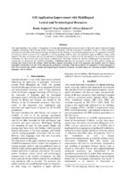
GIS Application Improvement with Multilingual Lexical and Terminological Resources
... which is frequently a compound, is not in the morphological e-dictionary of compounds. For example, in order to determine the third inflectional transducer for kvarcna stena ‘quartz rock’, the following rule of the abovementioned procedure, imbedded in the query expansion application WS4QE ...
... ic rock, Def=A volcanoclastic rock formed by direct explosive volcanic activity, OrigID=2356, Lng=EN) {ID=12367, Name= Roches pyroclastiques, Def= Une pierre volcanoclastiques formées par l'activité volcanique explosive direct, OrigID=2356, Lng=FR) Figure 2: GeolISSTerm HH tree in GeolISSTerm ...
... a part of the interface for GeolISSTerm management with an example of a tree view for the concept Piroklastična stena’ Pyroclastic rock’, which has entries in English, Serbian and French: {ID=2356, Name=Piroklastična stena, Def= Stena nastala depozicijom i litifikacijom piroklasticnih naslaga; ...Ranka Stanković, Ivan Obradović, Olivera Kitanović. "GIS Application Improvement with Multilingual Lexical and Terminological Resources" in Proceedings of the 5th International Conference on Language Resources and Evaluation, LREC 2010, Valetta, Malta, May 2010, Valetta, Malta : European Language Resources Association (2010)
-
Definition of groundwater genesis and circulation conditions of the complex hydrogeological karst system Mlava–Belosavac–Belosavac-2 (eastern Serbia)
Ljiljana Vasić, Saša Milanović, Zoran Stevanović, Laszlo Palcsu. "Definition of groundwater genesis and circulation conditions of the complex hydrogeological karst system Mlava–Belosavac–Belosavac-2 (eastern Serbia)" in Carbonates and Evaporites, Springer Science and Business Media LLC (2020). https://doi.org/10.1007/s13146-020-00550-3
-
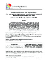
Pleistocene rhinoceros from Bogovina Cave: the first report of Stephanorhinus hundsheimensis Toula, 1902 (Mammalia, Rhinocerotidae) from Serbia
Finds of Pleistocene rhinoceros are rare in Serbia, and only one species (the woolly rhinoceros Coelodonta antiquitatis Blumenbach, 1799) has been reported so far. The current paper presents the dental material of an extinct so-called Hundsheim rhinoceros, Stephanorhinus hundsheimensis Toula, 1902 from Bogovina Cave (East ern Serbia). Both the morphological and metric characteristics of the teeth are consis tent with the attribution to S. hundsheimensis. Unfortunately, the rhinoceros material originated from an uncertain geological context, so there is no ...... the paracone fold is more developed in S. hundsheimensis than in S. etruscus (Lacombat, 2007). Invariably, a marked paracone fold can be observed in all upper molars from Bogovina Cave, which preserve the vestibular portion of the crown. Although hard to assess in the premolars, due to the wear (NMKVRS ...
... range of the species in Europe. Since the teeth show differences in colour and degrees of smoothing/polishing, they probably originated from different strata and were exposed to differential degrees of water-induced transport. As the geolog- ical context is lacking, it is very hard to hypothesise a more ...
... distal val- ley (although this trait is hard to assess due to the high degree of wear). The lower second premolar HMP-139a displays a V-shaped distal valley. The HMP-129 m1/m2 shows V-shaped mesial and dis- tal valleys. The openings of vestibular synclines in all three specimens are wide, about right-angled ...Predrag Radović, Miloš Radonjić, Emmanuel Billia. "Pleistocene rhinoceros from Bogovina Cave: the first report of Stephanorhinus hundsheimensis Toula, 1902 (Mammalia, Rhinocerotidae) from Serbia" in Palaeontologia Electronica, Coquina Press (2020). https://doi.org/10.26879/985
-
Geochemical study of U, Th and REE mineralizations in Jurassic sediments and hydrochemical characterization of groundwaters in Eastern Serbia – Case study: Plavna area
Jovan Kovačević, Maja Todorović, Marina Ćuk, Petar Papić . "Geochemical study of U, Th and REE mineralizations in Jurassic sediments and hydrochemical characterization of groundwaters in Eastern Serbia – Case study: Plavna area" in Carpathian Journal of Earth and Environmental Sciences (2016)
-
Joint interpretation of paleomagnetic, structural and AMS results from the Vardar Zone of Serbia
Emo Marton, Marinko Toljić, Vesna Lesić, Vesna Cvetkov. "Joint interpretation of paleomagnetic, structural and AMS results from the Vardar Zone of Serbia" in 18th Meeting of the Central European Tectonic Studies Group (CETEG) & 25th Meeting of the Czech Tectonic Studies Group, 22-25th April, 2021, Terchová, Slovakia, Department of Geological Sciences, Masaryk University in cooperation with the Czech Geological Survey, IPE MU Brno and UK Praha (2021)
-
Анализа одрона у стенским косинама: савремени приступи
Милош Марјановић (2023)У Србији и региону познате су бројне појаве одрона које су изазвале велике застоје саобраћаја, материјалне штете или чак имале фаталне исходе, па их је потребно непрестано пратити и изучавати. Mодeловањe одрона скопчано је са ниским нивоом поузданости, али савремене технологије омогућавају да сe такви изгледи донекле побољшају. Једна од технологија која чини искорак утом правцу јe LiDAR-ско скенирање, које обезбеђује детаљне топографске подлоге у виду облака тачака високе резолуције и тачности. Поступак анализе одрона може се свести на: ...Милош Марјановић. "Анализа одрона у стенским косинама: савремени приступи" in Записници Српског геолошког друштва, Београд : Српско геолошко друштво (2023)


