Претрага
20 items
-
Preliminary regional landslide susceptibility assessment using limited data
Igor Peshevski, Milorad Jovanovski, Biljana Abolmasov, Jovan Papic, Uroš Đurić, Miloš Marjanović, Ubydul Haque, Natasha Nedelkovska (2019)In this paper a heuristic approach for preliminary regional landslide susceptibility assessment using limited amount of data is presented. It is called arbitrary polynomial method and takes into account 5 landslide conditioning parameters: lithology, slope inclination, average annual rainfall, land use and maximum expected seismic intensity. According to the method, in the first stage, a gradation is performed for each of the carefully selected conditioning parameters by assigning so called rating points to the grid cells on which the ...Igor Peshevski, Milorad Jovanovski, Biljana Abolmasov, Jovan Papic, Uroš Đurić, Miloš Marjanović, Ubydul Haque, Natasha Nedelkovska. "Preliminary regional landslide susceptibility assessment using limited data" in Geologica Croatica , Croatian Geological Society (2019). https://doi.org/10.4154/gc.2019.03
-
Хазард од клизишта у Србији у 21. веку
Biljana Abolmasov (2019)Biljana Abolmasov. "Хазард од клизишта у Србији у 21. веку" in Геохазард у Србији у 21. веку – знање је најбољи бедем против стихије, Српска академија наука и уметности (2019)
-
Stabilnost starih klizišta u tercijarnim terenima šireg područja Beograda-priobalje Save i Dunava
Gordana Hadži-Niković (1995)Gordana Hadži-Niković. Stabilnost starih klizišta u tercijarnim terenima šireg područja Beograda-priobalje Save i Dunava, Beograd:Rudarsko-geološki fakultet, 1995
-
Results of comprehensive monitoring activities on Umka landslide, Belgrade, Serbia
Biljana Abolmasov, Uroš Đurić (2021)Biljana Abolmasov, Uroš Đurić . "Results of comprehensive monitoring activities on Umka landslide, Belgrade, Serbia" in 3rd European Regional Conference of IAEG/ Athens/ Greece/ 6-10 October 2021, IAEG National Group Greece (2021)
-
Klizišta, odroni i problemi stabilnosti padina u jugoistočnom dijelu spoljašnjih Dinarida (Primorski pojas od Bojane do Splita)
Staniša Ivanović (1979)Staniša Ivanović. Klizišta, odroni i problemi stabilnosti padina u jugoistočnom dijelu spoljašnjih Dinarida (Primorski pojas od Bojane do Splita), Beograd:Rudarsko Geološki Fakultet, 1979
-
Primena metode povratne analize kod sanacije klizišta
Ksenija Đoković (2002)Ksenija Đoković. Primena metode povratne analize kod sanacije klizišta, Beograd:Rudarsko-geološki fakultet, 2002
-
Geneza i svojstva klizišta u neogenim sedimentima južnog oboda Panonskog basena
Ivo Janjić (1996)Ivo Janjić. Geneza i svojstva klizišta u neogenim sedimentima južnog oboda Panonskog basena, Beograd:Rudarsko-geološki fakultet, 1996
-
Geostatički proračuni sanacije klizišta šipovima
U ovom radu su, polazeći od rezultata geotehničkih istraživanja, prikazani geostatički proračuni sanacije klizišta vertikalnim šipovima. Metodologija proračuna je složena, jer podrazumeva interakciju klizišta i stabilizirajućih šipova. Stoga se simultano analiziraju stabilnost klizišta i stabilnost šipova. Prilikom određivanja bočne otpornosti tla oko šipova koristi se metoda Brinč Hansena koja uzima u obzir trodimenzionalne uslove u tlu i može da se primeni u složenim geološkim uslovima koji su česti u Srbiji. Analize stabilnosti klizišta vrše se odgovarajućim metodama granične ravnoteže. ...sanacija klizišta, interakcija klizišta i šipa, bočna otpornost šipova, stabilnost klizišta i šipovaSlobodan Ćorić, Dragoslav Rakić, Dušan Berisavljević. "Geostatički proračuni sanacije klizišta šipovima" in Zbornik radova osmog naučno-stručnog međunarodnog savetovanja - Geotehnički aspekti građevinarstva, Savez građevinskih inženjera Srbije, (2019)
-
Highway construction in fossil landslides zones – Lessons learned from the Grdelica Gorge, Serbia
Landslides are common on roads, which directly affect the flow of traffic and the connection and functioning of the population in surrounding area. Therefore, it is necessary to investigate them in the shortest possible time and to determine and carry out the remediation solution. Functionality of the state roads is immensely important so it is necessary to ensure that the traffic is maintained during remediation activities. Therefore, design solutions and remediation execution technology should be adapted to these requirements. ...Biljana Abolmasov, Marinos Skempas, Svetozar Milenković, Janko Radovanović, Miloš Marjanović. "Highway construction in fossil landslides zones – Lessons learned from the Grdelica Gorge, Serbia" in 5th Regional symposium on landslides in Adriatic–Balkan Region, 23-26 March 2022, Faculty of Civil Engineering, University of Rijeka and Faculty of Mining, Geology and Petroleum Engineering, University of Zagreb (2022)
-
Permanent GNSS monitoring of landslide Umka
Mileva Samardžić Petrović, Jovan Popović, Uroš Đurić, Biljana Abolmasov, Marko Pejić, Miloš Marjanović (2020)Клизиште Умка је једно од највећих насељених активних клизишта у Србији. Активност клизишта Умка се прати већ више од 85 година, различитим геотехничким и геодетским техникама. Од 2010. године, активност kлизишта се континуирано прати у реалном времену аутоматизованим перманентним системом за праћење базираним на Глобалним навигационим сателитским системима (ГНСС). Поред тога, од 2018. године активност клизишта се додатно прати кинематичким ГНСС одређивањем положаја скупа карактеристичних тачака као и применом UAV фотограметрије. Главни циљ овог рада је приказ резултата опажања три ...Mileva Samardžić Petrović, Jovan Popović, Uroš Đurić, Biljana Abolmasov, Marko Pejić, Miloš Marjanović. "Permanent GNSS monitoring of landslide Umka" in International Conference on Contemporary Theory and Practice in Construction XIV Stepgrad, University of Banja Luka, Faculty of Architecture, Civil Engineering and Geodesy (2020). https://doi.org/10.7251/STP2014091S
-
Machine learning based landslide assessment of the Belgrade metropolitan area: Pixel resolution effects and a cross-scaling concept
Improvements of Machine Learning-based landslide prediction models can be made by optimizing scale, customizing training samples to provide sets with the best examples, feature selection, etc. Herein, a novel approach, named Cross-Scaling, is proposed that includes the mixing of training and testing set resolutions. Hypothetically, training on a coarser resolution dataset and testing the model on a finer resolution should help the algorithm to better generalize ambiguous examples of landslide classes and yield fewer over/underestimations in the model. This ...... cageo.2015.04.007. Gojgić, D., Petrović, N., Komad, Z., 1995. Katastar klizišta i nestabilnih padina u funkciji prosornog I urbanističkog planiranja, projektovanja i građenja. In: Drugi Simpozijum Istraživanje i Sanacija Klizišta, Donji Milanovac, 6–9 Jun 1995. Institut za puteve a.d. Beograd, Univerzitet ...
... Northern Calabria, South Italy. Geomorphology 134, 297–308. https://doi.org/10.1016/j.geomorph.2011.07. 006. Luković, M., 1951. Važniji tipovi naših klizišta i mogućnost njihovog saniranja. Geološki Vesnik IX, 275–310. (In Serbian). Mahalingam, R., Olsen, M.J., O'Banion, M.S., 2016. Evaluation of landslide ...
... Landslides 8, 459–483. https://doi.org/10.1007/s10346-011-0267-7. Ocokoljić, M., Jotić, M., Jelisavac, B., Šijaković, J., Janjić, I., 1984. Katastar klizišta i nestabilnih padina dela teritorije SO Grocka. Printed map. (In Serbian). Palamakumbure, D., Flentje, P., Stirling, D., 2015. Consideration of optimal ...Uroš Đurić, Miloš Marjanović, Zoran Radić, Biljana Abolmasov. " Machine learning based landslide assessment of the Belgrade metropolitan area: Pixel resolution effects and a cross-scaling concept" in Engineering Geology , Elsevier (2019). https://doi.org/10.1016/j.enggeo.2019.05.007
-
Extreme Rainfall Event and Its Aftermath Analysis—IPL 210 Project Progress Report
Biljana Abolmasov, Mileva Samardžić Petrović, Ranka Stanković, Miloš Marjanović, Jelka Krušić, Uroš Đurić (2021)Biljana Abolmasov, Mileva Samardžić Petrović, Ranka Stanković, Miloš Marjanović, Jelka Krušić, Uroš Đurić. "Extreme Rainfall Event and Its Aftermath Analysis—IPL 210 Project Progress Report" in Understanding and Reducing Landslide Disaster Risk, Springer International Publishing (2021). https://doi.org/10.1007%2F978-3-030-60196-6_19
-
A proposal for the landslide damage questionnaire in suburban areas
Landslides are one of the most often natural disasters that have an extensive impact on society including loss of life, destruction of infrastructure and properties, damage to land and loss of natural resources. Landslide losses can significantly vary and they depend on a variety of different criteria such as the size and type of landslide, lithological setting of terrain, the terrain slope gradient, the quality of materials used for construction, and the construction typology. Damage from landslides is usually ...Uroš Đurić, Biljana Abolmasov, Miloš S. Marjanović, Sanja Jocković, Miloš D. Marjanović. "A proposal for the landslide damage questionnaire in suburban areas " in 5th Regional symposium on landslides in Adriatic–Balkan Region, 23-26 March 2022, Faculty of Civil Engineering, University of Rijeka and Faculty of Mining, Geology and Petroleum Engineering, University of Zagreb (2022)
-
Metodologija proračuna sanacije klizišta šipovima
Klizišta u Srbiji, u najvećem broju slučajeva, jako zavise od geoloških uslova u terenu i svako klizište ima svoje specifičnosti koje moraju da se odrede geotehničkim istraživanjima. Stoga su u radu prvo prikazane osnovne karakteristike klizišta u Srbiji, kao i postupci njihovog istraživanja. Zatim su prikazani proračuni sanacije klizišta vertikalnim šipovima. Metodologija proračuna je složena, jer podrazumeva interakciju klizišta i stabilizirajućih šipova. Prilikom određivanja bočne otpornosti tla oko šipova koristi se metoda Brinč Hansena koja uzima u obzir trodimenzionalne ...klizišta, geotehnička istraživanja, bočna nosivost šipova, interakcija klizišta i šipa, analiza stabilnostiSlobodan Ćorić, Dragoslav Rakić, Stanko Ćorić, Dušan Berisavljević. "Metodologija proračuna sanacije klizišta šipovima" in V simpozijum društva za Geotehniku R. Severne Makedonije, ISRM Specialized Conference, Društvo za Geotehniku Severne Makedonije (2022)
-
Процјена хазарда и ризика од клизишта за различите нивое просторног планирања у Републици Српској, БиХ
Цвјетко С. Сандић (2022)Територија Републике Српске је у посљедних десетак година веома угрожена активирањем нових и реактивирањем старих клизишта. Она својим дјеловањем наносе огромне материјалне штете, па и људске жртве, те је неопходно озбиљније третирање и дјеловање у борби са овим природним хазардом. Чест проблем јесте одговорност, тј. надлежност институција из ове области и недостатак у законској регулативи која готово никако или само површно обрађује област хазарда и ризика од клизишта. Усљед непостојања праксе и усвојених методологија које су у примјени у свијету, циљ ...Цвјетко С. Сандић. Процјена хазарда и ризика од клизишта за различите нивое просторног планирања у Републици Српској, БиХ, Београд : [Ц. Сандић], 2022
-
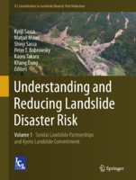
Results of Recent Monitoring Activities on Landslide Umka, Belgrade, Serbia—IPL 181
Biljana Abolmasov, Uroš Đurić, Jovan Popović, Marko Pejić, Mileva Samardžić Petrović, Nenad Brodić (2021)Biljana Abolmasov, Uroš Đurić, Jovan Popović, Marko Pejić, Mileva Samardžić Petrović, Nenad Brodić. "Results of Recent Monitoring Activities on Landslide Umka, Belgrade, Serbia—IPL 181" in Understanding and Reducing Landslide Disaster Risk. WLF 2020. ICL Contribution to Landslide Disaster Risk Reduction, Springer, Cham (2021). https://doi.org/10.1007/978-3-030-60196-6_14
-
Multihazard Exposure Assessment on the Valjevo City Road Network
Miloš Marjanović, Biljana Abolmasov, Svetozar Milenković, Uroš Đurić, Jelka Krušić, Mileva Samardžić Petrović (2019)Miloš Marjanović, Biljana Abolmasov, Svetozar Milenković, Uroš Đurić, Jelka Krušić, Mileva Samardžić Petrović. "Multihazard Exposure Assessment on the Valjevo City Road Network" in Spatial Modeling in GIS and R for Earth and Environmental Sciences, Elsevier Inc (2019). https://doi.org/10.1016/B978-0-12-815226-3.00031-4.
-
Concepts for Improving Machine Learning Based Landslide Assessment
... org/10.1016/j.cageo.2015.04.007 Gojgić D, Petrović N, Komad Z (1995) Katastar klizišta i nestabilnih padina u funkciji prostornog i urbanističkog planiranja, projektovanja i građenja, II Simpozijum Istraživanje i sanacija klizišta, D. Milanovac, Srbija, pp 103–111 (in Serbian) Guzzetti F, Mondini AC, Cardinali ...
... istraženosti i kritička analiza metodologije dosadašnjih istraživanja stabilnosti terena beogradskog područja, Simpozijum Istraživanje i sanacija klizišta, Bled, Slovenija, Knjiga 1. Zbornik radova, pp 107–118 (in Serbian) Bradley AP (1997) The use of the area under the ROC curve in the evaluation ...Miloš Marjanović, Mileva Samardžić Petrović, Biljana Abolmasov, Uroš Đurić. "Concepts for Improving Machine Learning Based Landslide Assessment" in Natural Hazards GIS-based Spatial Modeling Using Data Mining Techniques, Advances in Natural and Technological Hazards Research, volume 48, Springer Nature Switzerland AG 2019 (2019). https://doi.org/10.1007/978-3-319-73383-8_2
-
Integrating landslide magnitude in the susceptibility assessment of the City of Doboj, using machine learning and heuristic approach
In this work, landslide assessment of the Doboj City area was modeled by combining machine learning and heuristic tools. The machine learning part was used to map the Morphometric factor. i.e. probability of landslides based on relation between the magnitude of events and morphometric parameters: elevation, distance to streams, slope, profile curvature, and aspect. The Random Forest and Support Vector Machines algorithms were implemented in the learning protocol, which included several strategies: balancing of the training/testing set size, algorithm ...Cvjetko Sandić, Miloš Marjanović, Biljana Abolmasov, Radislav Tošić. "Integrating landslide magnitude in the susceptibility assessment of the City of Doboj, using machine learning and heuristic approach" in Journal of Maps, Taylor&Francis (2023). https://doi.org/ 10.1080/17445647.2022.2163199
-
The ‘Umka’ landslide
We present an in-depth landslide map of the ‘Umka’ landslide near Belgrade, Serbia, at a scale of 1:5000. The map delineates elements at risk, primarily buildings and road infrastructure impacted by the landslide displacements of several cm per year, introduced during frequent reactivation stages. The Main map results from a survey of over 350 buildings and more than 7 km of state and local roads. The acquisition techniques included engineering geological field mapping, building survey, and visual interpretation of ...rizik od klizišta, elementi rizika, kartiranje pomoću drona, ispitivanje objekata, geotehnički monitoringUroš Đurić, Dragana Đurić, Miloš Marjanović, Biljana Abolmasov, Ivana Vasiljević. "The ‘Umka’ landslide" in Journal of Maps, Informa UK Limited (2024). https://doi.org/10.1080/17445647.2024.2418580
